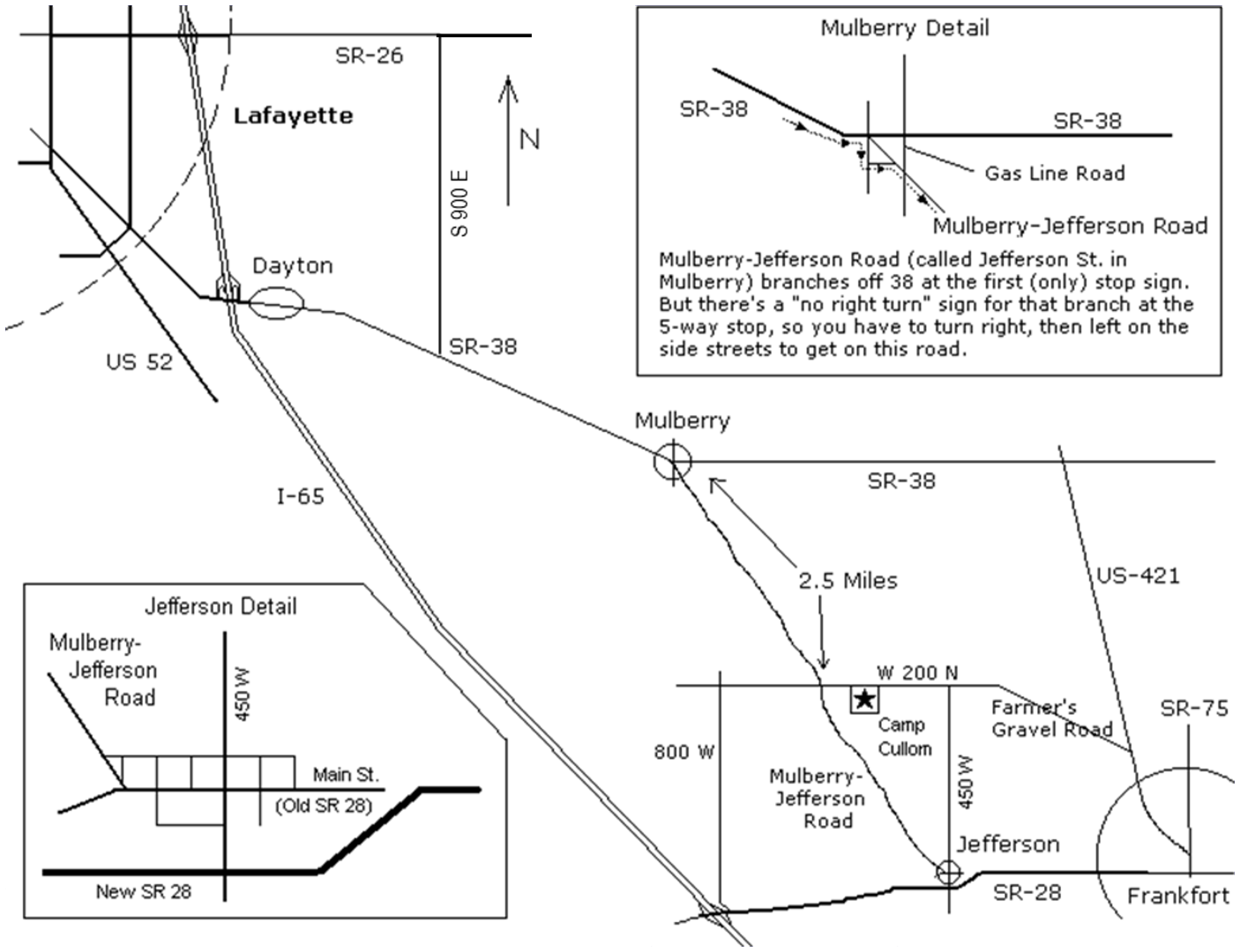
Camp Cullom is located between Chicago and Indianapolis near Lafayette.
Note that summer is construction season so make sure you note any construction that might in your travels to us. You can check the Indiana road closures online.
INTERACTIVE GOOGLE MAP TO CAMP CULLOM
REGIONAL MAP TO CAMP CULLOM WITH MULBERRY &JEFFERSON INSERTS
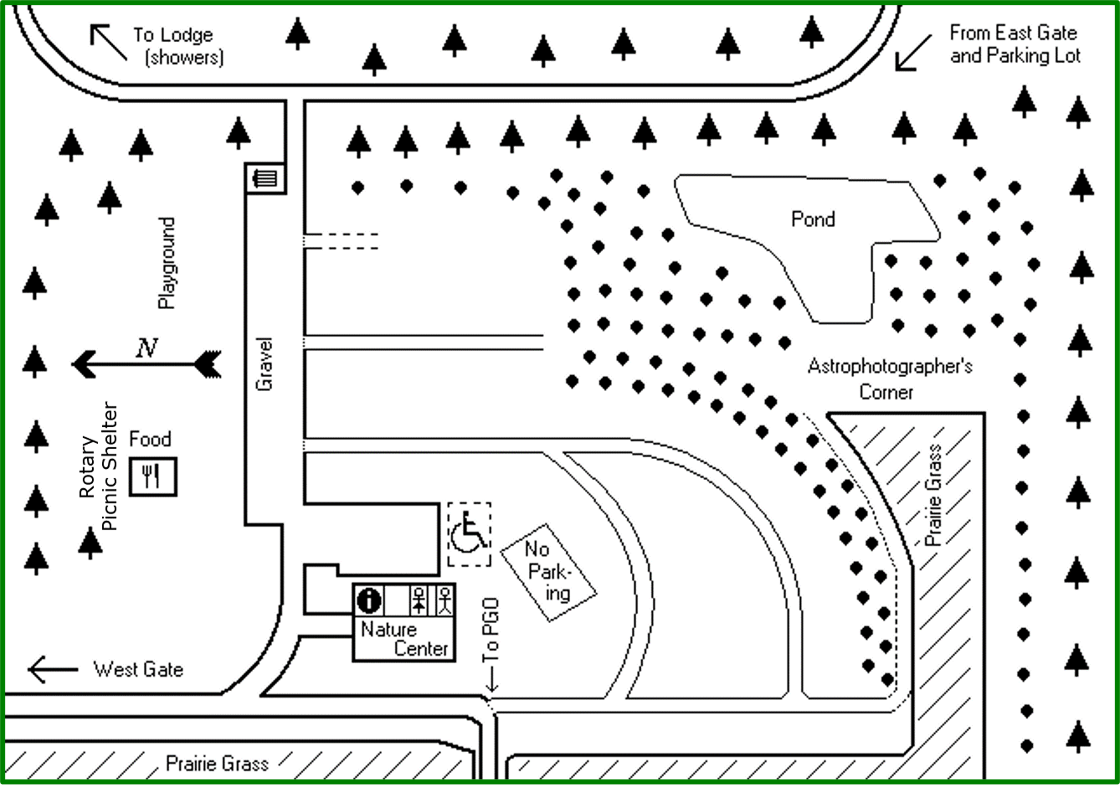
The east gate (down the hill) will be used for most traffic this year.
If you have an RV, use the west gate and call the number posted for someone to let you in and help get you checked in and a spot found for your vehicle.
MAP OF CAMP CULLOM
Full-event parking is in the Observing Field behind the Nature Center. (RVs with generators please park near the food vendor area.)